
Wyandotte Postal ZIP Coverage
The principal postal ZIP for Wyandotte is 48192. Nearby 48193 belongs to the adjacent Riverview postal area. The second row is important because a postal boundary can change without changing a city parcel. Use the exact-address USPS result to settle delivery assignment rather than assigning a ZIP by proximity.
| ZIP | Areas covered | Post office | Notes |
|---|---|---|---|
| 48192 | Wyandotte postal delivery area | Wyandotte Post Office, 231 Eureka Road | Principal city ZIP; USPS address lookup controls exact delivery assignment |
| 48193 | Riverview postal area adjacent to Wyandotte | Riverview Classified Branch/Post Office, 18231 Civic Park Drive | 2005 delivery-area realignment; not automatically a Wyandotte ZIP |
The documented postal records do not assign informal neighborhoods or population totals to either row. The research found no official per-ZIP Wyandotte population, voter-registration, or parcel count. Postal service areas should be kept at the level actually documented.
Wyandotte Postal ZIP 48192
48192 is Wyandotte’s principal USPS ZIP. The Wyandotte Post Office is at 231 Eureka Road, Wyandotte, MI 48192-9998. Published retail hours are Monday through Friday, 8:30 a.m. to 5:30 p.m.; Saturday, 9:00 a.m. to noon; and Sunday, closed. The local phone is 734-283-7158, while the USPS general number is 800-275-8777.
Those office details identify the principal postal counter, not a boundary survey. USPS FAST uses a “WYANDOTTE MI 48192” pair label for the 48192-48193 pair, but that is a mail-processing label rather than a statement of municipal territory. An address may use a postal city name without creating a legal conclusion about which city holds the parcel.
Note: Use a mailing ZIP to format mail and an official parcel or jurisdiction record to determine the land’s governmental location.
Riverview Postal ZIP 48193
The adjacent Riverview ZIP is 48193, served by the Riverview Classified Branch/Post Office at 18231 Civic Park Drive, Riverview, MI 48193-9998. A USPS Postal Bulletin effective July 1, 2005 announced 48193 for the Riverview Classified Branch and said that a portion of deliveries previously in the 48192 area moved to 48193. That documented delivery change is a useful warning against assigning a nearby parcel to a ZIP without an address check.
Use 48193 as the neighboring postal reference it is. It is not a label for every property close to the Wyandotte line, and a historical mailing record from the former delivery area still needs its own date and address validation. The 2005 change explains why a postal trail can look different across records without showing a move across a city boundary.
Verify a Wyandotte ZIP Code
The USPS ZIP Code Lookup is the verified address tool for a postal check. Its by-address route accepts a required street, city, and state, with company and apartment fields optional and ZIP optional. USPS also offers city-and-state and cities-by-ZIP modes. The result recognizes a delivery city and ZIP; its own disclaimer says the result does not confirm that a person or company is at the address.
| USPS control | Type | Required | Result or use |
|---|---|---|---|
| Company | Text | No | Optional address context |
| Street address | Text | Yes for address mode | Tests a deliverable location |
| Apartment | Text | No | Optional unit detail |
| City | Text | Yes for address mode | Part of the mailing-address query |
| State | Selector | Yes for address mode | Part of the mailing-address query |
| ZIP | Text | No | Optional validation detail |
| City/state or cities-by-ZIP | Alternate modes | Mode dependent | Postal-city and ZIP associations |
The official USPS ZIP Code Lookup screen shows the address, city/state, and cities-by-ZIP modes used for a postal check.
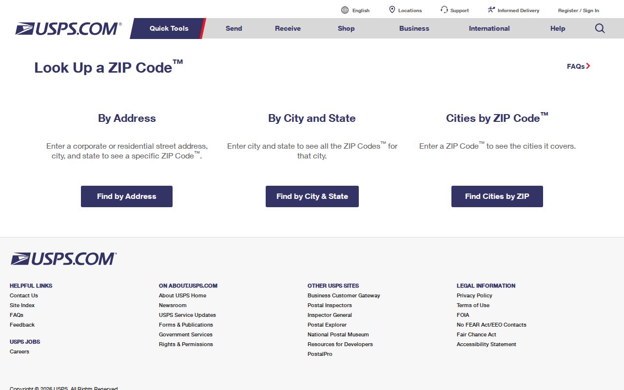
The screenshot supports an address-validation step, not a ZIP-wide list of residents. Retain the full address used for the check so a later parcel search can be repeated accurately.
Wyandotte ZIP Map Limits
Wayne County’s ZIP map includes 48192 and the nearby ZIP areas, but it was created in September 2019 and is based on or approximates 2010 Census geography. The map warns that ZIP boundaries are approximate. It is useful for broad spatial context, not for confirming a deliverable address or deciding city jurisdiction parcel by parcel.
Use the sources in sequence. USPS answers the delivery-address question. The county ZIP map gives approximate geography. The Wayne County Parcel Viewer identifies a land parcel and its selected ID. The City Assessor and the parcel’s legal description then provide the local land-record bridge. This comparison prevents a postal line from doing work it was not made to do.
Note: ZIP boundaries, postal city names, and Wyandotte city limits are separate geographic systems and should be documented separately.
From ZIP to Parcel Records
No inspected Wyandotte property portal offered a confirmed ZIP filter. That matters when someone expects a ZIP code directory to produce a ZIP-wide resident list. The Treasurer’s form searches by street number, street name, municipality, or complete parcel ID. BS&A exposes address, name, parcel, and service routes, but no verified ZIP filter. The Parcel Viewer also has no confirmed ZIP filter, and the public voter lookup has no verified ZIP field.
The Wyandotte BS&A municipal records landing page shows the service menu that leads to its address, name, and parcel routes.
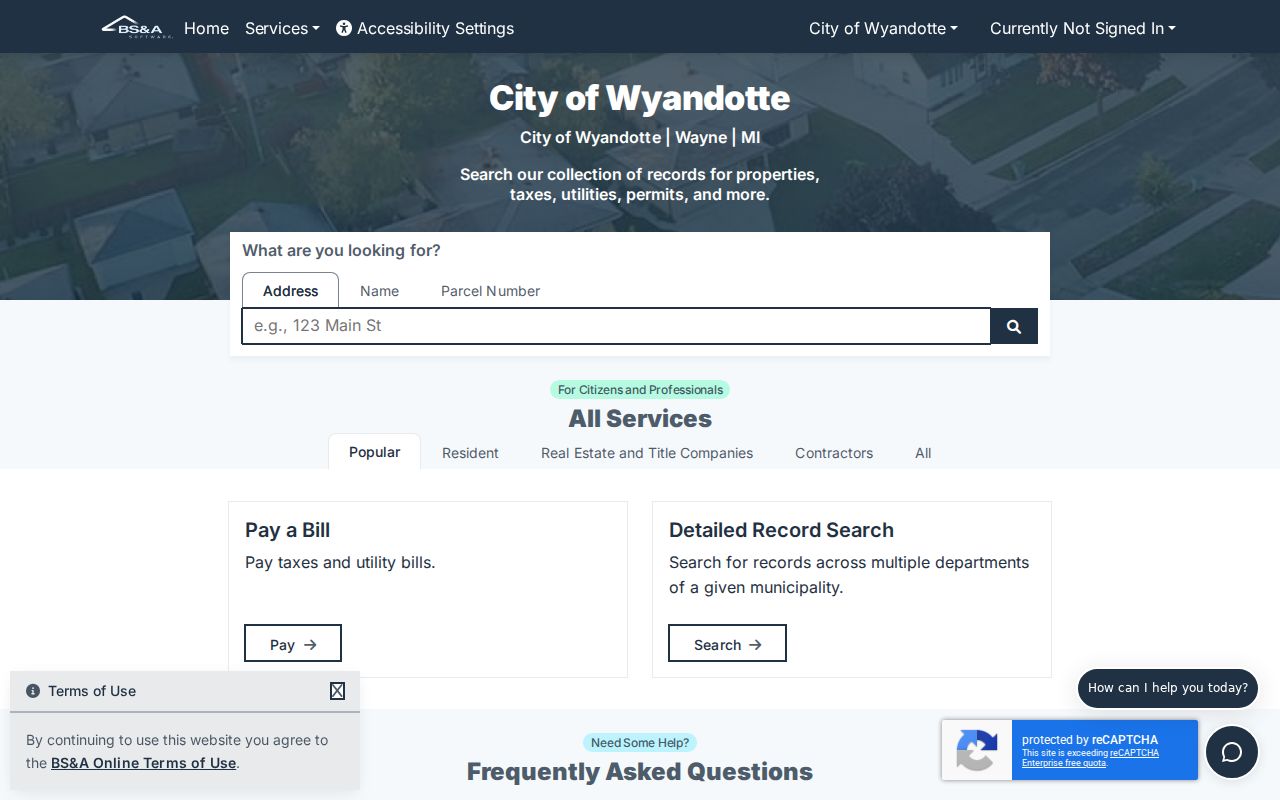
The screen supports the parcel bridge after postal validation, while confirming that an inspected ZIP-specific filter was not available.
- Enter the exact mailing address in USPS to validate the ZIP and delivery city. Do not treat that result as person confirmation.
- Use the validated street and city in the Wayne County Treasurer lookup or in Wyandotte BS&A to locate an address or parcel record.
- Select the parcel in the county viewer and preserve its parcel ID, situs address, and legal-description context for the next search.
- For a registration question, use the person-based Michigan tool or a lawful QVF request. Requestable street-address and precinct data remain subject to redactions and protected-address rules.
- When the ZIP has narrowed the area to a street, use the Wyandotte street directory workflow for the address-keyed record chain.
ZIP can narrow a mailing question. It cannot replace an address, parcel number, legal description, or the date of a record.
Wyandotte ZIP Search Limits
Neither a USPS result nor a ZIP label confirms a person or company at an address. USPS says so directly, and its purpose is delivery validation. The property, tax, and map systems document different things: a parcel, a property relationship, a tax trail, or map geometry. A postal directory should not turn any of those separate records into a claim about a whole household. It also cannot supply a verified ZIP-wide total for Wyandotte because no official ZIP-level population, voter-registration, or parcel count was found in the research.
Michigan’s public voter tools are person-based, not a public ZIP roster. A written QVF data request can address requestable street-address and precinct information, but the request carries legal acknowledgments and protected fields remain withheld or substituted. Driver-license and state-ID numbers, month and day of birth, and protected addresses are not a ZIP-search shortcut. A no-result can reflect a move, a spelling difference, an inactive or cancelled registration, privacy protection, or an incomplete update.
When postal and parcel information point in different directions, preserve both results and ask the relevant custodian about the particular record. Do not infer a protected physical address or fill an official data gap with a nearby ZIP.
Pre-ZIP Wyandotte Address Trails
Historical directories are not ZIP-keyed. Bacon Memorial District Library’s city directories are organized by street number, and their local coverage predates ZIP codes. For a 1900 address, begin with the street and house number, then compare city plats and census enumeration rather than adding a modern postal code. The same warning applies to an old tax or deed record whose legal description predates a current mailing label.
Wyandotte’s numbered streets add another check. The city street-history archive describes early streets roughly parallel to the Detroit River and identifies Front or First as the street later called Van Alstyne Boulevard. An older label may therefore need a street-name bridge before it can be compared with a current parcel. A current 48192 mailing label is not proof that an earlier directory entry used the same geography.
The strongest older trail combines the directory’s date, the street name then in use, adjacent house numbers, a plat or Sanborn sheet, and the parcel’s legal description. That is more reliable than retrofitting a ZIP to a period when it did not exist.
Wyandotte ZIP Boundaries
A USPS “Wyandotte” city line does not make every address legally inside the City of Wyandotte. Likewise, a county mailing address such as Detroit or Riverview can appear on a Wyandotte tax card without moving the situs parcel. Test municipal location with the City Assessor, county parcel map, and legal description. Test delivery with USPS. Keeping those tasks apart is the central limit of a postal-ZIP search.
- ZIP versus ZIP+4
- A ZIP identifies a postal delivery area. ZIP+4 adds a more specific delivery segment within that system; it does not establish land jurisdiction.
- PO-box ZIP
- A ZIP assigned for post-office-box delivery rather than a general street-delivery area. The research did not identify a Wyandotte PO-box-only ZIP.
- Unique ZIP
- A postal ZIP associated with one institution or organization. No unique Wyandotte ZIP was documented in the research.
- Carrier route
- A USPS delivery grouping used to organize mail movement. It is not a city boundary or a public resident roll.
Postal searches also cannot prove that a person or company is at an address. Protected voter addresses and other restricted records should not be inferred from a ZIP result. Use the exact public record, its date, and the responsible custodian for any follow-up.