
Wyandotte Previous Resident Sources
Past residents of one Wyandotte address have to be traced through record sets that describe different facts. The city assessor and deed index are useful for a property and its owners. Directories and census records help with dated household evidence. Tax rolls, maps, permits, newspapers, and probate files can narrow a period when the main chain is incomplete. The dates below are collection coverage, not a promise that every search result is available online.
| Source | Years It Covers | Where Held | What It Shows |
|---|---|---|---|
| Wayne Register of Deeds | Online cutoff needs verification: after 1986 or an older 1960 statement | Public portal, office, books, and staff route | Recorded conveyances, parties, legal description, document references |
| Wyandotte tax assessment rolls | 1868-1911 | Archives of Michigan, RG 68-30 | Historical assessments and a taxpayer or property trail |
| Delinquent-tax roll | From 1869 | Archives of Michigan, RG 2019-163 | Delinquent property and tax-name trail |
| City directories | Polk sporadic 1898-1998; digital 1898-1936; museum 1887-1992 | Bacon, CONTENTdm, and museum archive | Address and occupant clues, subject to gaps |
| Federal and state census | Federal public through 1950; state census locally reported 1855-1925 | Library, museum, and census channels | Household snapshot at the census date |
| Sanborn map | March 1922, 33 sheets | Library of Congress and local research channels | Lot, building, street-number, and use context |
Start with the current parcel when the question is about ownership. Begin with a dated address source when the question is who lived here before. A deed chain is ownership history, not a complete occupancy history. The previous residents trail begins only after the ownership and household evidence are kept distinct.
Starting a Wyandotte Address Trail
The City of Wyandotte Assessor directs property users to BS&A and states that owner information is free. Use the present-day situs, meaning the physical property address, to identify the parcel. Copy the owner name, parcel number, legal description, assessment details, exemption information, and any visible building-record reference before moving to a deed search. Preserve the city, street spelling, and number exactly as returned.
Keep the situs separate from the mailing address. A mailing address is used for tax correspondence and can point somewhere else. It may be a useful search lead, but it does not prove that the owner lived at the property. Likewise, an exemption is a tax classification, not a conclusion about every person connected to the address.
For a current property search, Wyandotte BS&A Online offers address, name, and parcel routes. The live parcel-card field list was not captured in the research, so record only fields actually displayed in the result.
Wyandotte Deeds for Past Residents
The backward deed method begins after the current parcel has been identified. Search the current owner as a grantee, which means buyer or recipient, in the Wayne County land-record index. Open or request the purchase instrument, then search that instrument's grantor, the seller or transferor, as an earlier grantee. Match the legal description at every transfer. Names can shift into a trust, estate, corporation, or spouse's name, so all party and entity variants need to be checked.
- Find the current Wyandotte parcel and save the legal description, parcel number, and current owner separately from the mailing address.
- Search the owner as grantee in the Wayne County Land Records portal and locate the acquisition deed using the date, document type, address, or legal description where available.
- Record the grantor, grantee, recording date, document number, liber or page reference, legal description, and stated consideration if shown.
- Search the prior grantor as a grantee, then repeat the same legal-description check through earlier conveyances.
- When the online trail ends, use the Register of Deeds appointment route, county records staff, deed books or microfilm, the Archives of Michigan, library copies, or a written request.
- Grantor
- The person or entity transferring an interest in a recorded instrument.
- Grantee
- The person or entity receiving that interest. In a purchase deed, this is commonly the buyer.
- Chain of title
- The sequence of recorded transfers for the same property interest. It traces title, not everyone who occupied the address.
- Legal description
- The lot, block, subdivision, or metes-and-bounds land description used in recorded documents. It remains useful when a street address changes or is omitted.
Wyandotte Previous Resident Deed Portal
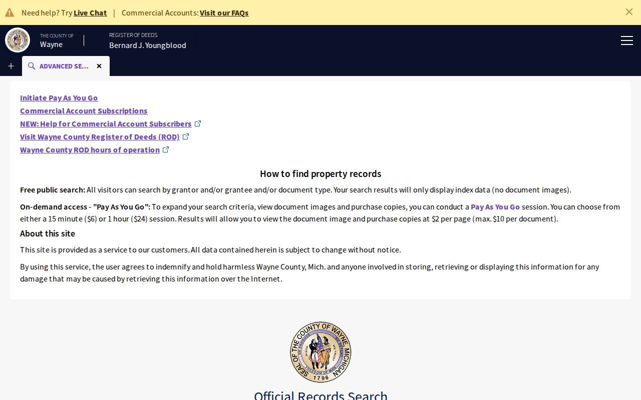
The online date boundary needs a clear caution. The current Register of Deeds landing page says recorded documents after 1986 are online. An older official county search-services page describes public online records dating to 1960. No single imaging-cutover document resolves the difference, so neither date should be presented as a guaranteed boundary for a particular instrument. Verify what the portal returns, then use the office or archival channel for earlier material.
The current Wayne County public-search portal is a starting point for recorded land documents, not the whole historical record. The Register of Deeds office page is the controlling source for appointments and present office logistics. The research notes that appointments became required in October 2025, so confirm the current procedure before an in-person visit.
The Wayne Land Records public-search source is shown below as the first online channel.
Do not promise that a pre-1960 or pre-1986 deed image will appear online. The documented fallback is the counter, appointment, records staff, older books or microfilm, library help, archives, or a written request.
Wyandotte Tax Roll History
When the deed chain enters the nineteenth or early twentieth century, the Archives of Michigan Wayne County guide identifies Wyandotte tax assessment rolls for 1868-1911 in RG 68-30 and delinquent-tax material from 1869 in RG 2019-163. These records can establish a historical taxpayer or property context that the modern portal does not supply.
The same guide identifies county probate calendars from 1797-1914, case files from 1797-1901, estate files from 1901-1968, and related will and register groups. Those dates explain why a past-residents search may become an archive task long before a current web portal reaches the relevant year.
Note: A tax roll can support a dated property trail, but it does not prove a complete household lived at the address.
Wyandotte Past Residents in Census
To identify previous residents rather than only prior owners, pair each deed date with the local directory and census layers. Bacon's Polk directories are sporadic from 1898-1998, the digitized Bacon run covers 1898-1936, and the museum lists directories from 1887-1992. The collections, access conditions, and entry cautions are set out with the Wyandotte city directory collections. A directory may supply a yearly address clue, while a census provides a household snapshot at its own date.
- Place each confirmed deed in date order and keep its legal description attached to the parcel.
- Find the nearest available directory years on both sides of that deed date, using surname variants and the old street form where needed.
- Record an address and any volume-defined mark exactly as printed, without treating an owner mark as an occupancy conclusion.
- Compare the nearest public federal census date, currently through 1950, or the locally reported state-census holdings for 1855-1925.
- Use a newspaper, obituary, cemetery index, or probate record to test a move, death, or estate transfer suggested by the timeline.
This pairing keeps the roles distinct: a deed records title, a directory can identify a listed address, a tax roll records an assessment trail, and a census records a household at a particular census date. None of them alone answers every house-history question.
Bacon Local History accepts a research request or appointment for a home question and can bring together directories, newspapers, tax lists, photographs, and maps. Request the address, old street form, and date range rather than a general ownership answer. The library does not promise a completed title abstract, so its materials should be added to, not substituted for, the deed sequence.
Wyandotte Sanborn Street Names
The verified Library of Congress Wyandotte Sanborn map is dated March 1922 and contains 33 sheets. It can show a lot, building footprint, street number, adjoining structures, and use at that date. It is not a resident list and may not identify an owner. Use it to test whether a building or number existed when a directory or deed suggests it did.
Street continuity also needs care. The city street-history archive says early streets were roughly parallel to the Detroit River and numbered, while Front or First later became Van Alstyne Boulevard. For an old Fifth, First, or Front address, compare the historical name, a plat or Sanborn sheet, and adjacent numbers before assigning it to a modern address. No complete official year-by-year renumbering bridge was found.
Note: A shared number does not establish that an older and current address describe the same parcel without the legal description or map context.
Wyandotte Resident Trail Endpoints
Obituaries, funeral-home microfilm, cemetery indexes, and probate files can close a historical trail, but each has a limited role. Bacon lists Thon Funeral Home microfilm from 1921-1995 and Wyandotte death-record microfilm from 1897-1998. An obituary can offer relatives, a last address, a service location, or burial clues. Probate files can identify heirs, fiduciaries, and estate assets. Confirm important vital facts with the appropriate official record.
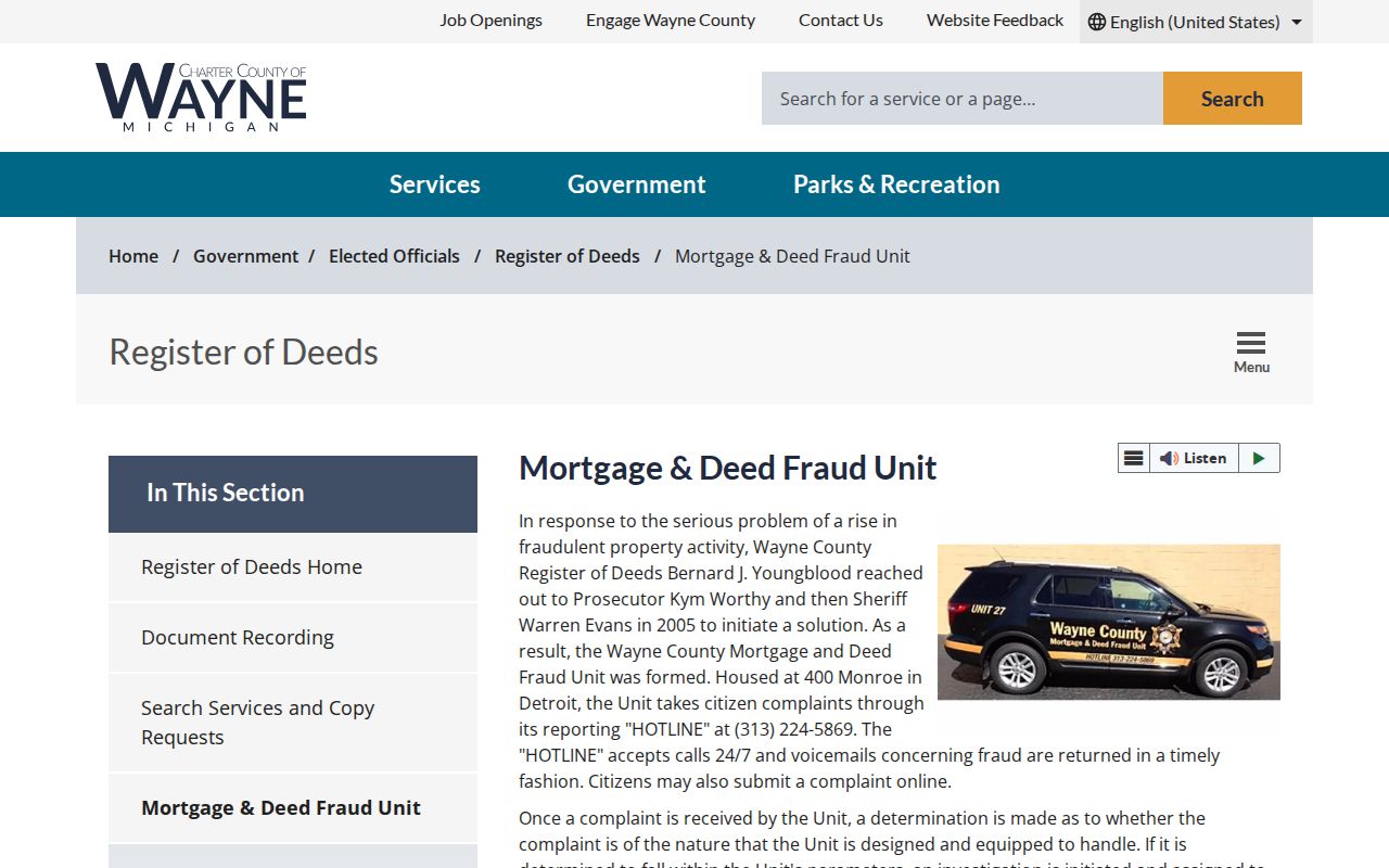
Fraud alerts are useful for a current property owner, not for identifying past residents. The Wayne Deed Fraud Unit was created in 2005 and offers a hotline and Property Alert or Fraud Guard notices for names matched to newly indexed documents. It does not provide title opinions, owner lookups, estate answers, or legal advice.
The County deed-fraud source describes the alert and complaint route.
Use past-residents research for family history, house history, estate matters, or personal property research. Do not use records to track, intimidate, harass, or harm a living person. Michigan's stalking law, MCL 750.411h, provides the relevant legal boundary.
Lawful house-history use. Record each source and date, share only what is necessary, and stop if research would intrude on a living person's safety or privacy.