
Wyandotte Neighbors: Block Sources
Public records describe parts of a block, not a complete social map. A parcel viewer can show the geometry and identifier for adjoining land. A property record can identify the recorded owner or a tax-mailing relationship. The voter file is a separately regulated source for public registration and precinct information. City contacts and older directories give community or historical context, but none prove that every person connected to a street currently lives there.
| Source | What It Shows About a Block | Access |
|---|---|---|
| Wayne County Parcel Viewer | Adjacent parcel boundaries, parcel IDs, and map context | Public interactive map with pan, zoom, and selection |
| Wyandotte BS&A | Property, tax, or building record for each selected address | Basic public search; card fields can vary |
| Wayne tax lookup | Address or parcel tax-query route, including a street segment | Public address or complete-parcel-ID search |
| Michigan QVF | Lawfully requestable registration and precinct context | Public lookup or authorized request, with redactions |
| City Resource Directory | Civic organization and municipal contact leads | Public category, name, and alphabet search; no member roster |
| Directories and newspapers | Historic occupants, notices, and block-era context | Bacon, museum, or digitized collection, with gaps |
Recorded owner and current neighbor are not interchangeable terms. A tax mailing address may differ from the parcel situs, an estate or entity can be the recorded party, and public property data does not identify every household member. Keep the source, date, parcel ID, and type of relationship with each result.
Map a Wyandotte Neighbor Block
The County Parcel Viewer is the careful way to move from one target address to the parcels beside it. Wayne County confirms that its interactive maps support panning, zooming, and feature selection. Start at a readable block scale, select the target polygon, and select each next polygon directly. Do not guess adjacency from street numbers, because a corner, alley, irregular lot, or changed numbering pattern can make nearby numbers misleading.
- Open the Wayne County Interactive Maps route and choose the Parcel Viewer. Pan and zoom until the target parcel boundary is clear.
- Select the target parcel and record its parcel ID, situs address, and any public map result. Treat that identifier as the handoff between map and property systems.
- Click each adjoining parcel polygon one at a time. Record every selected ID and situs separately instead of estimating which lots are adjacent.
- Use the selected address or parcel ID in BS&A, the tax lookup, or the deed index. Label the returned party as owner, taxpayer, grantor, grantee, or another record role.
- For a full named-street record chain, use the Wyandotte street directory rather than stretching a block method into a whole-street conclusion.
The map’s function is to establish a defensible parcel sequence. It does not establish who visits, who receives mail, or who is part of a private household. A map selection also should not be used to infer a protected address from nearby records.
Wyandotte Parcel and Tax Checks
After parcels are selected, the City Assessor and BS&A route can be used for the property record. If an address format does not match, the public menu also supports name or parcel-number approaches. Save a situs address separately from a mailing address. The expected property evidence includes an owner name, parcel, legal description, assessed or taxable values, and exemption indicators, but no single field should be treated as proof of current personal presence.
The Wyandotte BS&A municipal records route is shown below. Its service menu is the official starting point for assessing, tax, building, and other city record paths.
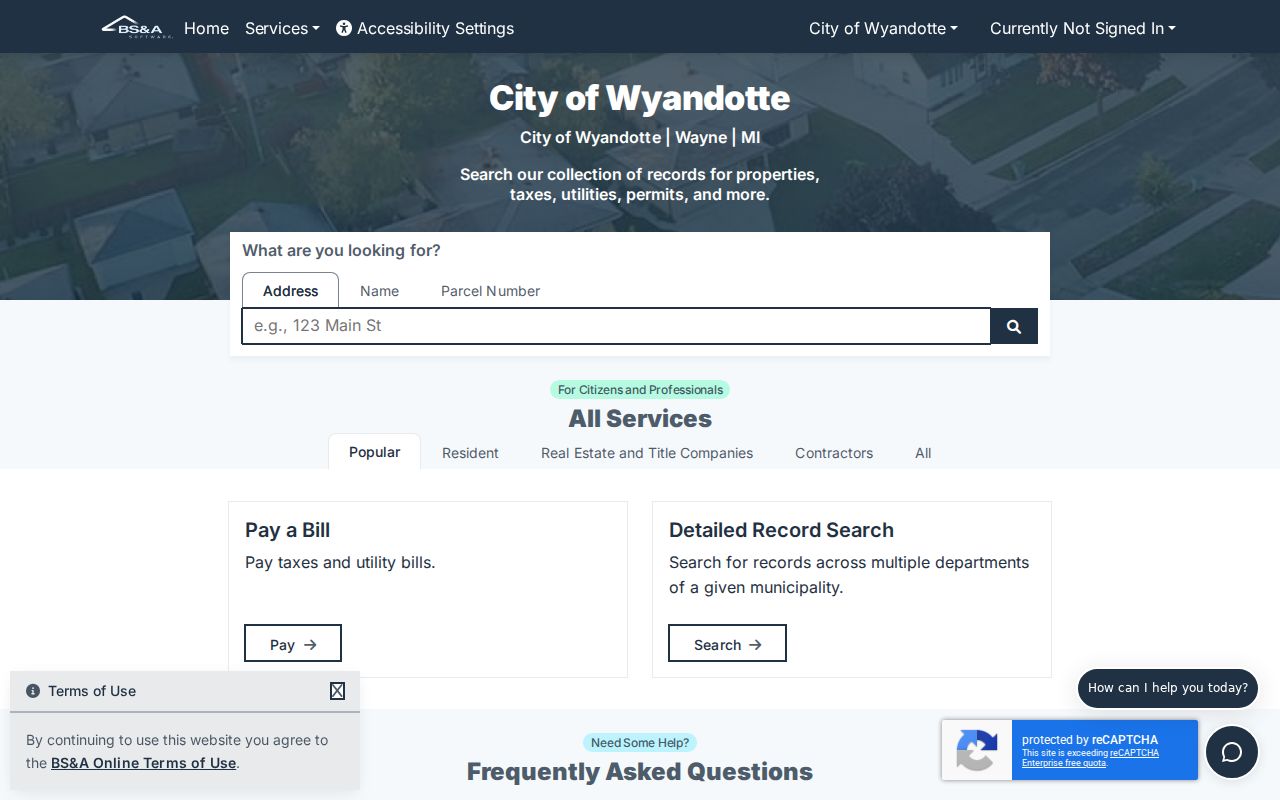
Choose the service and search mode that match the selected parcel. A result can connect a record party to property evidence, while the map and source date preserve the block context.
The Wayne County tax lookup is useful for a street segment. In address mode, leave Street Number blank, enter the first three or more letters of Street Name, omit the suffix, and choose Wyandotte from the optional Municipality control when appropriate. The search is case-insensitive. That mechanism returns a whole-street route without inventing a separate neighborhood boundary.
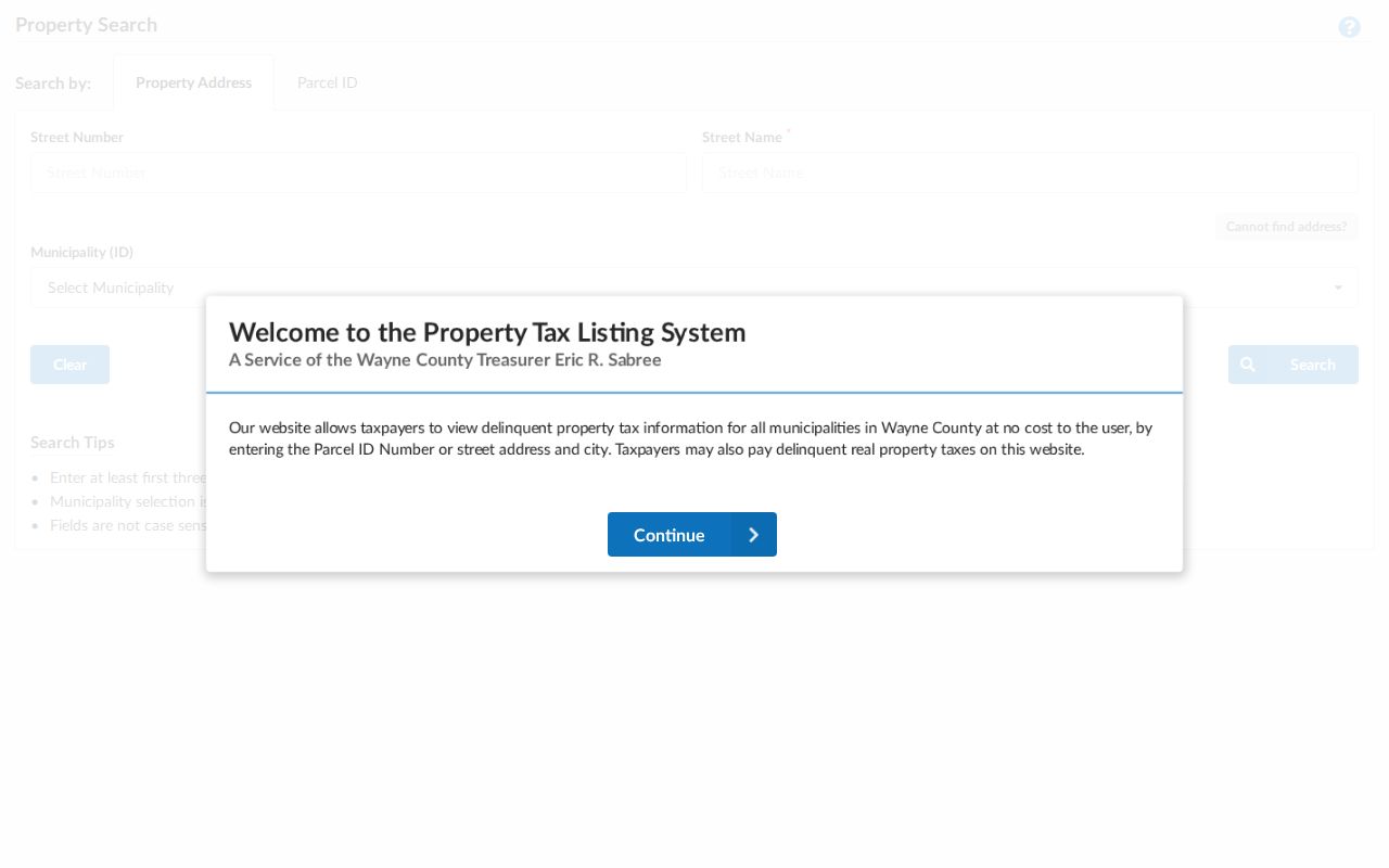
The official form shown above separates address and parcel modes. For a parcel query, the complete ID is required; non-Detroit IDs are described as 14 to 16 characters without spaces or dashes. Use the result to check a selected parcel, not to turn a tax screen into a list of neighbors.
| Tax lookup field | Use for a block check |
|---|---|
| Street Number | Optional. Leave blank for the whole-street address route. |
| Street Name | Required in address mode. Enter the first three or more letters and omit the suffix. |
| Municipality | Optional. Select Wyandotte to narrow the route, or leave blank to search more broadly. |
| Complete Parcel ID | Required only in parcel mode and best used after a map selection. |
Wyandotte Precinct, Not Household, Data
Michigan’s Qualified Voter File has a statewide street-address index that identifies city, township, and precinct. That supports public jurisdiction context around a selected block. It is not a public screen for finding every neighbor on a street. The ordinary public lookup is person-based, while a fuller QVF request is subject to the request form’s legal acknowledgment and the applicable public-record limitations.
Registration information is public with redactions under Michigan Election Law. Driver-license and state-ID numbers and month and day of birth are withheld. The public lookup does not disclose ballot choices. A QVF request can identify defined vote-history categories, but the request must follow the FOIA and DPPA notice. A response should be handled as a separately authorized data set, not merged automatically with parcel results.
Michigan’s Address Confidentiality Program adds another boundary. An enrolled voter can have a substitute address used by state and local agencies. That address is not an invitation to discover the person’s physical location. A no-result can also reflect a move, spelling difference, inactive or cancelled status, or a protected record.
Wyandotte Neighbor Community Contacts
The Wyandotte Resource Directory provides public civic and institutional contact leads, not a private-resident directory. It can be searched by alphabet, category, or name. Organizations may supply meeting information or a public contact, which can help someone understand a block’s community context. Those listings do not establish that a person belongs to a group or lives at any particular parcel.
The official city resource directory is shown below. Its organization categories are a useful place to find public contacts without turning community activity into a claim about private members.
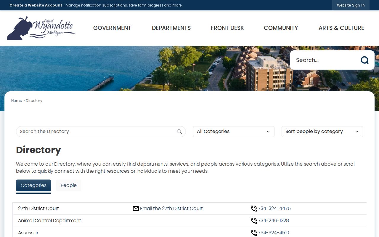
Use the listing itself for current contact details. The inventory below preserves the distinction between a public organizational lead and a roster.
| Organization | Public community context | Directory status |
|---|---|---|
| Exchange Club of Wyandotte | City directory listing with a public contact and meeting note | Contact listing only |
| Kiwanis Club of Wyandotte #1000 | Organized in 1923; its listing provides public contact and weekly meeting information at 2903 Biddle | No member roster located |
| Knights of Columbus #1802 | Council or corporation listing with hall address and phone | No member roster located |
| SUDDs Coalition | City directory describes a multi-sector volunteer coalition | No member roster located |
Wyandotte Neighbor Source Comparison
Official records and commercial neighbor-finding tools serve different purposes. A government-held parcel or court record has a named custodian, a stated access rule, and a way to seek an official copy. Commercial tools are category-level compilers. They can combine public indexes, marketing data, historical addresses, and third-party feeds, so their update timing and matching rules may be unclear. Use a formal record to verify a specific fact rather than treating an assembled profile as final.
| Source category | Useful for | Important limit |
|---|---|---|
| Official parcel, tax, or deed record | A recorded land or tax relationship tied to a specific parcel | May show an owner or mailing party, not every current occupant |
| Official QVF or court route | Defined registration, precinct, or public case information | Redactions, exclusions, and authorized-request rules apply |
| Library directory or newspaper | Historical household and block-era leads | Dates, abbreviation keys, and digitization gaps must be checked |
| Commercial neighbor tool | A possible starting lead for a name or old address | Can be stale, mismatched, incomplete, or unable to reflect protected records |
For an address discrepancy, return to the relevant custodian. The assessor can address assessment information, the Register of Deeds holds recorded instruments, and a court or election office governs its own record. A single compiled result should never override those source-specific limits.
Historic Wyandotte Neighbors by Street
Older block research needs a different set of sources. Bacon Memorial District Library holds local city directories, newspapers, obituary indexes, yearbooks, funeral-home microfilm, tax lists, photographs, and primary city documents. Its Polk directories are reported as sporadic from 1898 through 1998, and Bressers material continues from the 1980s into the present. The digitized Wyandotte City Directories collection covers 1898 through 1936, but an online volume should be checked against shelf gaps and the volume’s abbreviation key.
Wyandotte’s river-parallel numbered-street plan creates a local search complication. The city’s street-history archive identifies Front or First as the later Van Alstyne Boulevard. Search an old street reference as a historical alias, then compare adjacent numbers, a plat or Sanborn sheet, and the modern parcel. A directory entry is a period clue, not evidence of a person’s current identity or address.
Note: The city’s 1922 Sanborn map has 33 sheets and can establish lot, building, number, and street context without identifying every person connected to that block.
Wyandotte Block Record Requests
When the map, tax form, and published index do not answer a narrow records question, request the identified record. Michigan Freedom of Information Act, 1976 PA 442, MCL 15.231–15.246, calls for a written request detailed enough for the custodian to find it. A response is normally due within five business days, with a possible 10-business-day extension. Review, search, copying, and delivery charges can be itemized.
Use the Wyandotte FOIA route for a specific city-held record, identifying the address, date range, parcel ID, record type, and requested fields. City records can be inspected or copied subject to exemptions. For deeds, use the Register of Deeds. For a historic directory or notice, ask Bacon or the museum for a particular volume or issue. Broad requests for protected personal information will be denied or released only with redactions.
Privacy Limits on Neighbor Search
Public parcel data is not a list of all Wyandotte neighbors. It does not reveal private utility customers, delivery data, every household member, protected voter information, sealed court matters, or motor-vehicle address data. The Driver’s Privacy Protection Act and MCL 257.208c restrict personal information from motor-vehicle records. A property card may show a recorded owner relationship while leaving many ordinary personal details outside public access.
Michigan’s Address Confidentiality Program can provide eligible survivors and people at risk with a substitute address and mail forwarding. State and local agencies must use that designated address. Do not attempt to infer a protected physical address from adjacent parcels, voter records, social contacts, or an older directory. Community contacts are for public communication, not for identifying private members.
Lawful use. Neighbor research is appropriate for personal, lawful property curiosity, reconnecting, family history, and public civic context. Never use an address, record, or community contact to watch, stalk, harass, threaten, or intimidate another person.